Services
We Use State Of The Art Technology
Laser Scanning
Laser scanning is a relatively new technology, having been used as a praise survey instrument only since 1998. Now it is quickly becoming the new industry standard as a way to make very accurate measurements in complicated environments.
Software
We employ several drafting programs and other software packages including Autocad 3D, IntelliCad, Carlson SW; Terramodel, Maptitude, Corpscon, Vertcon, Cyclone, Cloudwoks and MS Office. The main office is equipped with a network, computer systems, a full complement of printers, plotters, copiers, and email access to all employees.
Capacity
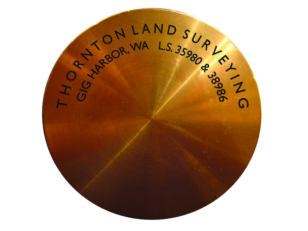
Thornton Land Surveying has a capacity to operate three crews and regularly engages GPS, robotic, and conventional surveying tools as well as state-of-the-art laser scanning.

Laser Scanning
Laser Scanning
3D Laser Scanning is quickly becoming the new industry standard as a way to make very accurate measurements in complicated environments. We have used our scanner with superior results when collecting data in areas such as roadways where safety and access are of concern. This is precisely why using this technology is the best solution for measuring as-built conditions. This instrument colects survey data points at a rate of 50,000 points per second. It has an effective range of 400′ to 500′. With several “scan” setups inside a room or of a building, a complete 3D model can be made of the existing conditions. These models are then used to create 2D civil or architectural drawings, 3D computer models, and final survey documents.
How does it work? In simple terms, our machine sends out a beam of light at a rate of several passes per minute over selected surfaces. As this light beam reflects off of one of these surfaces the time and angle of the return is calculated and converted into 3D data points. The scanner can be set to calculate these data points at a millimeter level of accuracy if needed. What results is a ‘point cloud’ of data that accurately models the scanned surface. An integrated digital camera meshes with the point cloud to provide real world colors. This assists in the final point selection and visual continuity.
The laser scanner is not unlike many technologies commonly taken for granted in science fiction movies. This technology is already in practice in such forms as LIDAR for earth and terrestrial scanning. And to a much smaller degree, modeling and artistry scans are used extensively for accurate recreations for movie props, and computer animation. The differences between these scanners and ours are the limits of range and level of detail possible. Our scanner falls comfortably in the middle of these two extremes.

Standard Boundary Survey
Standard Boundary Survey
The core of our profession is defining and mapping occupational ownership, marking deeds, and opining issues regarding the construction and intent of those deeds. Our expertise as Licensed Surveyors can help determine the limits of one‘s described and deeded property and which, more often than not, is fully accepted by all adjoining neighbors. In the process of this work we are often obligated by law to create a survey map which must include evidence of occupation.
The research we perform will typically include reviewing your deed and those of surrounding properties, road alignments and other public interests, shorelines, easements and other agreements and encumbrances, historical evidence, the public record (County Auditor’s office), and available credible and pertinent testimony. A survey of this manner may bare witness to a difference between title and occupation. Our findings can assist the client and their neighbors in resolving and correcting any discrepancies. It may also serve as the primary tool used by the client and an experienced land-use attorney in clearing potential defects in title or in defending or asserting a claim of ownership.

Aquatic Services
Aquatic Services
State law defines “aquatic lands” as all tidelands, shorelands, harbor areas, and the beds of navigable waters. Issues regarding everything from ownership boundaries and aquaculture leases to shoreline development often require the services of a professional surveyor.
Tideland Lease
Proposals for the use of state-owned aquatic lands, with a few exceptions, require prior authorization from the Washington State Department of Natural Resources (DNR). One of the requirements of authorization is a survey of the leased lands delineating any water dependent physical features as well as the extent of the lease.
Bathymetric Soundings
Often times in the process of completing a survey of aquatic lands it is necessary to know the shape or contour of the submerged lands. This is most easily obtained through the use of equipment specificity designed for this purpose. Sounding equipment combined with GPS signals gives us a complete picture of the site and how it can be surveyed or developed.
Buoy Applications/Location
The DNR application for the installation of a buoy requires a vicinity map, mark ed with the position of the buoy or boat lift, acquired either by a differential corrected Global Positioning System (GPS) measurement or by conventional surveying methods. A licensed surveyor must provide this information, or you must document it as follows:
A. List the anchor position coordinate, with a state plane grid coordinate or a latitude and longitude.
B. Detail the survey method used to mark the position of the buoy or boat lift.
Tideland/Land Survey
Tideland owners are often concerned about what it is that they actually own since in most cases they are described simply as “Tidelands Abutting”. There can be questions as to the extent of the tidelands side to side (laterally) as well as in extent, that is, how far out. These issues are complex and not easily delineated. The rules for resolving these issues are likewise complex and can involve every tool at a surveyors disposal.
Boundary Line Adjustment
Boundary Line Adjustment
Just as it sounds, this is the process of adjusting the boundary between two or more properties or lots and which cannot result in the creation of additional lots.
Each jurisdiction handles this process differently, therefore costs can vary substantially. We always recommend consulting with an attorney whenever there is a lender involved, or property is going to be conveyed to another party or entity. When in its simplest form, we can handle and direct you to the proper forms and formats. Again, it is important to remember that most cities and counties have applications and specific requirements which must be addressed before they can be accepted or officially recognized. Be prepared to spend some time and money addressing these bureaucratic conditions.
Boundary Line Agreement
Similar to an adjustment, but typically this involves properties under different ownership and often this is a reference to the quasi-legal process of averting a lawsuit or other civil disagreements.

FEMA Elevation Certificate
FEMA Elevation Certificate
A form required for flood insurance rate determination and or occupancy permit.
If you have recently, or are planning to refinance your waterfront property, or are in the process of constructing a new structure thereon, than your lender, insurance agent, or inspector has probably required you to get an ‘Elevation Certificate‘. Your insurance company will not be able to provide a rate, and/or you will not get your final occupancy permit (where applicable) until you have acquired this. lt is required that these forms be completed by a Licensed Surveyor, Licensed Engineer, or Licensed Architect. Few, if any engineers or architects have the proper tools or comfort level to perform these tasks efficiently, thus making the surveyor a prime contact point for this product. These forms have beoome more prevalent every year since the mid-1990s, and hurricane Katrina motivated FEMAto up the ante even more. The process involves establishing a benchmark (usually via GPS [satellite] observation) on your property and acquiring specific height measurements of your home or property such as the elevation of the first livable floor and crawl spaoe/basement, garage slabs, appurtenant hardware (heat pumps, generators, etc) and other such key elements which might be damaged or lost in the event of a flood. Typically our fees can be recouped within 6-12 months based on a reduction in the insurance and assuming your structure is not within the flood plain. If it is found to be so, please remember that we are only the messengers.
Letter of Map Amendment (LOMA)
FEMA has a process by which a portion of property, or the structure thereon can be exempted (removed) from its national maps database. One such commonly used process and application is called a Letter Of Map Amendment (LOMA) In some circumstances it is generated in conjunction with the previously mentioned ‘Elevation Certificate. Often times, this application can be filed independently. Once removed, the portion of property or structure will no longer be scrutinized by the mapping clearing house which provide the insurance company with the red-flag of being subject to flood insurance. This is often recommended for the average, residential property. This process can often take three to six weeks to be processed. These forms require specific information to be gathered both on site and ‘of record’ in order to be processed and accepted by FEMA and related agents.
Forensic Boundary Survey
Laser Scanning
3D Laser Scanning is quickly becoming the new industry standard as a way to make very accurate measurements in complicated environments. We have used our scanner with superior results when collecting data in areas such as roadways where safety and access are of concern. This is precisely why using this technology is the best solution for measuring as-built conditions. This instrument colects survey data points at a rate of 50,000 points per second. It has an effective range of 400′ to 500′. With several “scan” setups inside a room or of a building, a complete 3D model can be made of the existing conditions. These models are then used to create 2D civil or architectural drawings, 3D computer models, and final survey documents.
How does it work? In simple terms, our machine sends out a beam of light at a rate of several passes per minute over selected surfaces. As this light beam reflects off of one of these surfaces the time and angle of the return is calculated and converted into 3D data points. The scanner can be set to calculate these data points at a millimeter level of accuracy if needed. What results is a ‘point cloud’ of data that accurately models the scanned surface. An integrated digital camera meshes with the point cloud to provide real world colors. This assists in the final point selection and visual continuity.
The laser scanner is not unlike many technologies commonly taken for granted in science fiction movies. This technology is already in practice in such forms as LIDAR for earth and terrestrial scanning. And to a much smaller degree, modeling and artistry scans are used extensively for accurate recreations for movie props, and computer animation. The differences between these scanners and ours are the limits of range and level of detail possible. Our scanner falls comfortably in the middle of these two extremes.

Indian Trust and Tribal Land Surveys
Indian Trust and Tribal Land Surveys
David is a Certified Federal Surveyor (CFedS) authorized by the Bureau of Land Management (BLM) to perform fee to trust, tribal trust documents, tribal land transfers, surveys, research, and other necessary and pertinent work required to satisfy Federal standards of work. The BIA and the BLM are encouraging tribal nations and tribal members to have title and real estate related projects performed by a CFedS. We can do this work for you.

BIM and 3D Scanning and Modeling
BIM and 3D Scanning and Modeling
Laser scanning is a relatively new technology, having been used as a precise survey instrument only since 1998. Now, it is quickly becoming the new industry standard as a way to make very accurate measurements in complicated environments. We have used our scanner with superior results when collecting data in areas such as roadways where safety and access are of concern. This is precisely why using this technology is the best solution for measuring as-built conditions. This instrument collects survey data points at a rate of 50,000 points per second. lt has an effective range of 400′ to 500′. With several “scan” setups inside a room or of a building, a complete 3-D model can be made of the existing conditions. These models are then used to create 2-D civil or architectural drawings, 3-D computer models, and final survey documents.
Land Segregation and Subdivision
Land Segregation and Subdivision
The act of dividing your property and to create additional lots or parcels. Almost all jurisdictions in Washington State require these various subdivisions to be performed by a surveyor licensed in the State.
There are numerous ways of performing a subdivision of land but the manners is which a particular county or city handles them varies greatly. In general, cities are cheaper and quicker than counties to process and approve the ‘land use’ applications described below. In all instances it is highly recommended that you meet with the staff of that jurisdiction prior to a formal application and that you bring your surveyor and an engineer and private planner, if necessary, to that meeting. These professionals can ask the questions pertinent to your project in order to provide you accurate information on how or even if you should proceed.
Short Plat/PBD
This application will allow you to divide your property into 2-4 or 2-9 lots depending on your zoning and the jurisdiction you are dealing with. These are the most common methods of dividing property and are fairly standard practices within a particular city or county. As such, we are usually able to advise you upfront on many of the criteria and point you to the proper ancillary professionals such as a civil engineer, a private planner, and an attorney.
Short plats are considered ‘administrative applications’ which means they are reviewed and considered only by staff of the city or county. Though neighbors do have a short period of appeal they, in general, they have little or no input on the conditions of approval.
Long Plat
A long plat is a means of dividing property into an unlimited number of lots. In general, though, that number is usually greater than what is allowed by a short plat since a short plat is (typically) cheaper and quicker to complete.
Long plats are NOT considered administrative reviews like a short plat. Therefore they have to go through public hearing wherein your neighbors are allowed to speak for or against your project and which may result in additional conditions of approval to satisfy their concerns. Long plats will almost always require engineering of the proposed road system, water, sewer, power, cable, and other amenities pertinent to the project. These are long, involved, and complicated applications which can take years to get approved, designed and finally built. In general, the more lots and area you are considering platting, the more expensive and timely and convoluted will be the process.
Large Lot
A division of land into any number of lots (2+) whereby ALL lots are larger than 5 acres (nominal).
This is a good way to break up large parcels of rural land where zoning will allow. Again, each jurisdiction will have differing requirements and procedures for this type of application for land use. It is typical that roads to all lots are designed or even constructed but often they can be gravel, and built to a lesser standard than those of a long plat.
Large lots are considered administrative applications meaning they are reviewed and considered only by staff of the city or county. Though neighbors do have a short period of appeal they, in general, they have little or no input on the conditions of approval.
Commercial Site Plan
A Binding Site Plan is an alternative method, provided under State law, for the division for sale or lease of commercially or industrially zoned property, mobile home parks, trailer parks or condominiums . It is a type of Site Plan that typically requires a review involving physical details related to the site and the type of use proposed and addresses such things as landscaping, design, parking location, and other site-specific issues.
Condominium
An often under-utilized but effective method of dividing land. Yes, condominiums can be used to subdivide land as well as buildings. The best way to understand a condominium is to think of it as a corporation wherein all of the occupants of the condo are like shareholders of a company. Each participant of a condo has their own defined boundary (horizontal and vertical) of which they can typically exercise similar rights provided to other types of property owners. A condominium will have ‘common spaces‘ which are to be enjoyed or utilized by all or certain members of the condo association (haltways, road access, foyers and play yards). They also contain ‘limited common space’ of which is utilized by all members but with restrictions on the type of use and access (area between walls, paths of utilities).
While most people consider a condo as being reserved for buildings, this same sort of division of ownership can be applied to land and which is referred to as an ‘Air-space Condominium’. The advantage to this method is that it is not subject to all the same levels of governmental review, and in fact, Washington State law dictates limits on local governments. In lieu of these reviews, the condominimizer must hire and attorney to draft up the condo declarations which are very specific and controlled in nature, and should be executed by one experienced in these types of documents in order to avoid or limit legal exposure to the membership. A land surveyor must also be retained for the purpose.
The lack of governmental review is limited to the land-use side of the equation but you will still have to go through site design approval and may still be subject to other forms of pertinent regulation review. But we are of the opinion that most attorneys are quicker than a planning department and the costs may likely be similar.
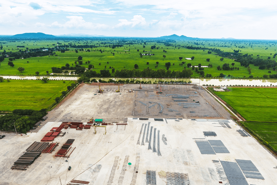
Construction Services
Construction Services
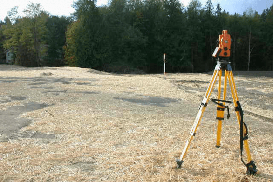
Our business was established on a foundation of construction layout and site development procedures. Few firms have the patience AND understanding of how to balance efficiency with accuracy. We understand that using RTK-GPS to set a building grid will likely result in costly mis-closures but that establishing a storm basin does not require first order control. We are of the opinion that bringing us onto your site to provide survey layout should be money well spent. When our crews are on-site, they strive to be efficient and task oriented.
Monitoring and Control
In conjunction with establishing high and mid level precision location of site improvements, we are also armed with several state-of-the-art instruments to monitor movement, both vertical and horizontal during and after completion. These include 3DHD laser scanner, robotic total station with remote measuring capability, electronic 3-wire level, and static GPS for high-precision network control. Providing a base-line and benchmarks for on-site control, usable by other contractors can usually be done on a tight budget.

Topographic Mapping
Topographic Mapping
Before you design or build, you may have need of an accurate map of the existing conditions. We provide the base-map of your plan–a point of beginning, in order that you may minimize costs, maximize use, and plan better. Simply put, a topographic survey map shows ground contours (lay of the land) physical improvements, natural conditions such has water and critical areas, protected or desirous trees and landscaping, underground and overhead utilities, and any other key elements of a project. Unlike a boundary survey, the data derived from a topographic map set out to define the site characteristics with 3-dimensional data (height and/or depth) on a 2»dimensional site plan.
Site Plans
This is a fairly basic product displaying rough site contours, critical elements such as wells, tops or toes of slopes, shorelines, and landscaping. Since these are mainly used by septic designers, architects and home—owners where the site contains few restrictions on area and use, accuracies and tolerances are low but costs are usually relatively affordable. We can usually work within a client’s budget and time constraints.
Engineered Site Design
A much more complex project, this product usually involves gathering information from local utility providers and municipalities in order to determine all potential and real encumbrances upon the property. We create a highly detailed map (where site conditions demand) in order that new buildings and improvements and their appurtenant infrastructure (storm runoff, water and sewer, power, etc) are located properly, and import and export of dirt and other materials is kept to a minimum.
New Construction
If planning a new home or commercial project it is often very helpful for design professionals to have access to a semi-detailed map of site conditions. This product falls somewhere between the a site plan and a full engineer design products previously discussed. Often these maps can be very basic, showing land contours,site corridors, zoning setbacks, and critical areas.
Additions and Remodel
Often required when expanding an existing commercial structure, or complicated residence where setbacks are critical. This product usually more often than not, requires some amount of boundary work in order to determine ownership-a main concern when expanding a floor plan, creating more parking or moving a septic field.
Building Height Restriction
Many municipalities and counties designate building height restrictions in a particular zone. This may also be a covenant or easement placed upon a particular property in order to protect views. The definitions and process vary, but in general these heights are based upon the average of the lot(s) and as such, it is a fairly straight forward process. How this ‘average’ is determined is often defined by municipal code.
If you have any Land Surveying needs...
Call Monday – Friday : 7:30 a.m. to 4:30 p.m, we are available for our customers.
